WhereIsMyTransport collects and digitalises public transport data in the field – with a primary focus on representing and advocating for informally run public transport in emerging cities. Through our integrated public transport data platform, we are enabling international organisations and Africa’s largest cities to make better investments and targeted decisions, so that everyone everywhere can get where they want to go. Since 2015, we have collected more data on public transport networks in African cities than any other organisation; we’ve mapped over 85,000 km of routes in 22 cities, across 11 countries.
By turning data into useful information, our platform empowers local developers, planners, and academics to build contextualised solutions to improve public transport in their city.
Data Collection
A common challenge for public transport projects in emerging markets has been the unavailability of formal and/or informally run transport operational data – including routes, stops, service information and fares. These data are necessary for understanding the status quo of mobility in cities, planning investments such as new transport services or system expansions, and to inform urban planning and policy at the municipal, regional, and national levels.
With extensive experience in Southern and Eastern Africa, we developed a collection methodology and a suite of tools to rapidly and accurately collect all the necessary data to generate a GTFS — General Transit Feed Specification — a format used by applications and services worldwide to visualise and access transport data.
Our API Platform
Our integrated platform for formal and informal public transport data encourages people to use public transport through convenient access to reliable journey information. The current lack of reliable and easily accessible information on disparate services makes it difficult to know where and when a vehicle is operating and how to navigate across systems. Thus, our integrated platform allows for a centralized space for data on different modes to be stored and utilized to improve journey navigation. It also empowers cities and operators to make data-supported decisions to effectively manage the whole urban mobility network, and strategically pinpoint and target challenge areas.
Our impact on Sustainable Mobility
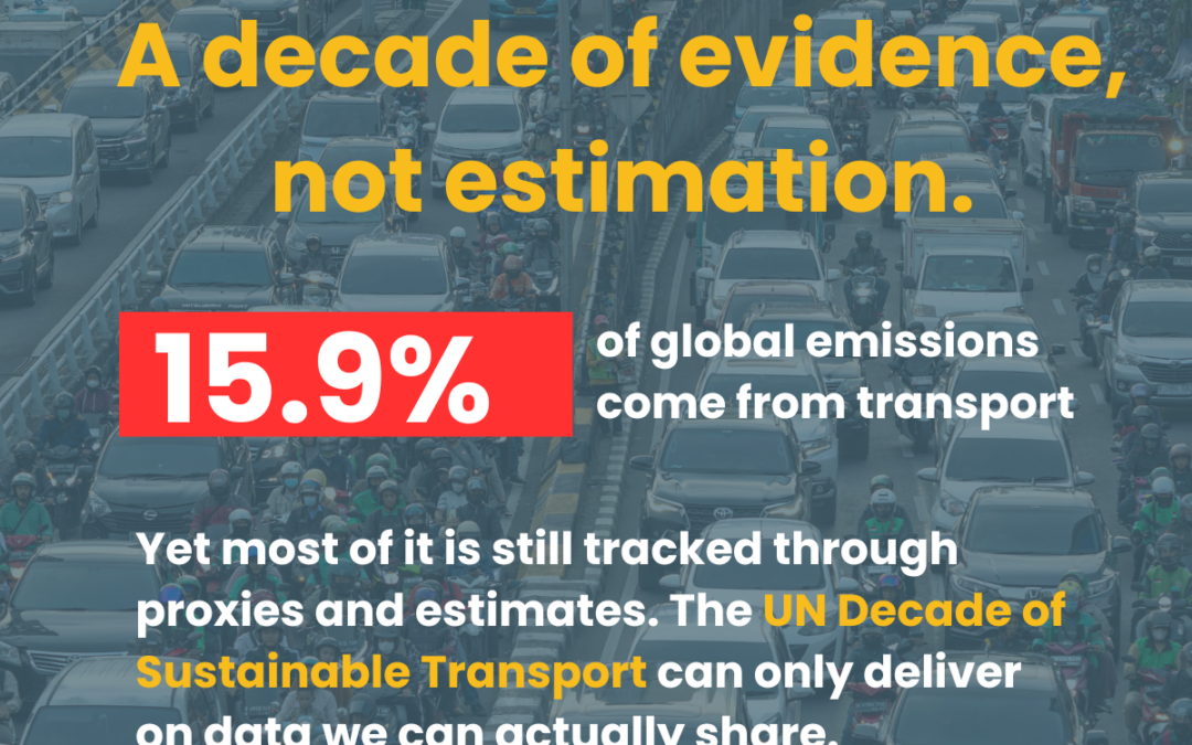
Transport activity accounts for almost 25% of global emissions. More alarmingly, resource inefficiencies and growing personal motorisation rates in emerging economies will, by 2030, result in 80% higher levels of total transport-related energy and carbon emissions as compared to 2007 levels.
At WhereIsMyTransport we are focussed on unlocking the potential of public transport in emerging economies. Current public transport systems in the emerging world rely heavily on informally run services, but inadequate management and lack of information on the full movement network has resulted in uncoordinated systems. This creates avoidable problems such as the oversupply of vehicles serving the same routes and a high difficulty in navigating journeys, translating into congestion and growing private motorisation rates.
In African cities, informally run transport makes up to 80% of all daily trips. However, there is little to no information about where, when, and how these systems run. By collecting and digitalising data on these informal systems and integrating it with formal data we provide a richer understanding of public transport in emerging cities.
Our data collection of informally run public transport allows for local governments and public transport authorities to make informed decisions about their transport networks. By having a full picture of their public transport systems on the ground, authorities can plan for fixed-schedule, formal public transport service expansions such as bus rapid transport (BRT) and rail networks. As African cities are rapidly growing, data on formal and informally run systems is needed to adequately match fluxes in demand across the city and thereby provide more sustainable public transport solutions to alleviate congestion in high-demand corridors, lower air pollution and increase public transport ridership.
Alongside our data collection efforts, we also provide trainings and workshops to government and public transport authorities on how to utilise their integrated public transport data to take an information-based approach to solving identified challenges in their city.